Images from space capture the massive flooding of the Euphrates River moments ago

Written By هشام جمال on 2026/06/02

This article was written originally in Arabic and is translated using a 3rd party automated service. ArabiaWeather is not responsible for any grammatical errors whatsoever.

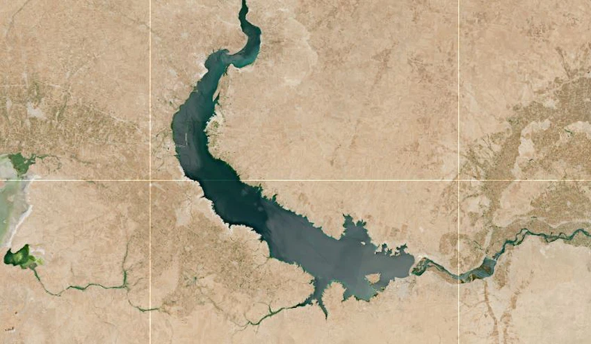
Arab Weather - Satellite images in recent days have revealed a clear expansion of the water area along parts of the Euphrates River, in a scene that reflects the large size of the flood and the remarkable rise in water levels in some areas adjacent to the river.

Time-based comparisons of satellite images showed an expansion of the flooded areas on both banks of the river, with water spreading into some nearby lands, reflecting the significant impact of increased water flows in recent times.

According to visual analyses of satellite images, the magnitude of the flood was evident from the vast areas affected by the water, with significant changes observed in the natural landscape of the river course compared to previous periods.

We ask God for safety for everyone.

This article was written originally in Arabic and is translated using a 3rd party automated service. ArabiaWeather is not responsible for any grammatical errors whatsoever.


Browse on the official website


Heavy rain, lightning, and hail hit the driest parts of the earthThe strength of the upcoming El Niño phenomenon promises an active autumn in various Arab regions.Is the Kingdom being affected for the first time by a heat dome and experiencing a heat wave?Drowning incidents and deaths in Syria due to the flooding of the Euphrates RiverThis is what awaits the Kingdom's atmosphere in the coming days.Meteorological Department: Rain, floods, and thunderstorms expected in these governoratesJordan: Is it time to say goodbye to winter clothes?Despite the official start of summer, weather fluctuations and thunderstorms are hitting seven Arab countries.