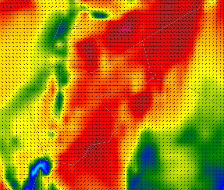
Beware of the formation of dense dust waves and strong winds blowing on desert roads and eastern plains tomorrow afternoon, Wednesday.
Arab Weather - The latest weather map analysis in "Arab Weather" indicates expectations of strong winds during the afternoon and evening hours of tomorrow, Wednesday, including the Badia regions and desert roads, in addition to the Jordanian-Iraqi and Jordanian-Saudi border crossings, including the Karameh border center near the Iraqi Trebil crossing, in addition to the areas located on the Jordanian-Saudi border, including the Mudawara border center and the Al-Omari border center.

Meteorologists at Arab Weather said that wind speeds may approach 80-90 km/h in these areas, especially the border areas, due to the expected differences in atmospheric pressure. A cold air mass is expected to approach the region on Wednesday, coinciding with the presence of a hot air mass to the east, which will produce a low-pressure area that will lead to significant activity in wind speeds in the aforementioned areas.
Beware of the formation of dense dust waves and possible loss of horizontal visibility.
Arab Weather warns of the risk of heavy dust storms and sandstorms in desert and open areas, as well as border crossings and surrounding areas. Horizontal visibility may be reduced at times.
Hence, we would like to emphasize to truck drivers and those visiting these areas the need to pay attention and take the utmost care and caution against the strong winds and sandstorms that may significantly impede horizontal visibility. The following are important recommendations from Arab Weather in light of the expected weather conditions:
- Be careful while driving, especially on desert and open roads due to low or no horizontal visibility.
- Avoid unnecessary travel during times of active winds and sandstorms, especially in border and desert areas.
- Wear protective masks, especially for those with respiratory conditions, to avoid inhaling dust.
- Close windows and doors tightly to prevent dust from entering homes.
- Pay attention to asthma and allergy patients and ensure they are not exposed to dust as much as possible.
- Follow the weather updates first
Browse on the official website