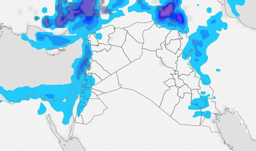
Bringing spring snow to mountain peaks, a cold air mass is affecting the eastern Mediterranean and the Levant, accompanied by radical changes in the weather (details)
Arab Weather - Most regions of the eastern Mediterranean basin, including the Levant, are experiencing dry and dusty Khamaseen weather, with daytime temperatures reaching 30 degrees Celsius in most areas. However, the latest computer outputs indicate a radical change in weather conditions in the region at the end of this week and the beginning of next week.
A cold air mass is affecting the Levant, accompanied by radical changes in weather conditions.
In detail, meteorologists at the Arab Weather Regional Center said that the latest computer outputs indicate that the region will be affected by a cold air mass coming from eastern Europe. This air mass will begin its impact starting at the end of this week on Syria, Lebanon, Palestine, Iraq, and Jordan, and will cause radical changes in the weather, as temperatures will drop and the weather will become relatively cold during the day, unlike in previous days. The cold weather will also become significantly cold throughout the region during the night hours.

Clouds are increasing and showers are falling on coastal areas, including Latakia and Tartous, in addition to the mountains overlooking the coast. Spring snow is expected to fall on the high mountain peaks, especially those above 2,000 meters above sea level in Syria and Lebanon, falling and accumulating snow amidst a deep winter atmosphere. We will see snow scenes, God willing. It is worth noting that some of the peaks of Mount Hermon exceed 2,800 meters above sea level, and are among the highest mountain peaks in the Levant and the Arabian Peninsula.
Active and cold winds will blow over Iraq and the northern Arabian Peninsula at the end of the week.
The cold air mass affecting the eastern Mediterranean is accompanied by brisk northwesterly winds blowing across Iraq and the northern Arabian Peninsula, stirring up dust and potentially causing dense dust waves with reduced horizontal visibility. Patients with respiratory and eye conditions are advised to take the necessary measures to avoid complications, God forbid.
And God knows best.
Browse on the official website