Syria | Storm Elias begins its direct impact on Latakia in the coming hours, warning of very heavy rains and possible flash floods
Update | Sunday 10/1/2023 AD at 10:00 PM
Arab Weather - Sinan Khalaf - The Arab Weather forecasting team is monitoring the possibility that the coasts of Syria will be affected during the coming hours of Sunday/Monday night and Monday dawn, specifically the city of Latakia, with the direct effects of Storm Elias, so that rain is expected to fall in great abundance, raising the possibility of the formation of torrents and the flow of valleys. .
Monitoring high chances of heavy thunderstorms that may affect Latakia tonight
It is expected that during the next few hours, the direct effects of Storm Elias will begin to affect Syria, starting with Latakia Governorate. It is expected that cumulus thunderclouds will be active in the skies of the governorate, increasing the frequency and intensity of rain, accompanied by the occurrence of lightning and thunder, with high chances of torrents forming and water levels rising in low-lying areas.
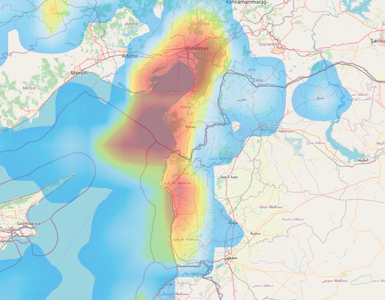
The concentration of rain clouds moves to the areas of Tartous with the dawn hours
In the hours after midnight, rain clouds move westward and concentrate on Tartous Governorate, where cumulus thunderclouds multiply and moderate and heavy rain falls, with increased chances of torrents forming locally.
During the day on Monday, the effects of Storm Elias on Syrian lands weaken, but the chances of rain continue to persist in many coastal areas with varying intensity, sometimes heavy and accompanied by lightning and thunder, and God knows best.
Browse on the official website