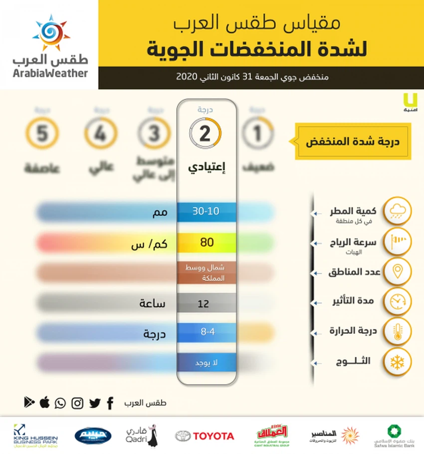
`Arab Weather` raises Friday's low rating from first class `weakest` to `regular` second
Weather of Arabia - The data received from the numerical models operating in the weather of Arabia indicate the development of the air depression that is expected to affect the Kingdom from the dawn of Friday to the second degree of "normal", according to the Arab Weather classification of air depressions , due to the strong impact of this cold air front on the neighboring countries And the possibility of some of its effects reaching north and central kingdom .
The depression is currently concentrated to the northeast of the island of Cyprus, and it is moving rapidly east, towards the north of the Syrian territories with the hours of morning and Friday afternoon, as the rest of the region crosses the main cold air front of this air system .
The low temperature is accompanied by precipitation in the north and central of the Kingdom, estimated in quantities varying from 10-30 millimeters within a simple period of time, which is concentrated on Friday morning. It is also accompanied by showers of hail and possibly thunderstorms.
The majority of the "hot rain" air activity will be concentrated within the period of influence of this cold air front which will cross with the hours of morning and Friday afternoon, amid cold weather accompanied by active winds to strong winds during most of the Friday periods.
Strong wind gusts accompanying the depression are expected to exceed the 80 km / h barrier in the high mountainous highland regions, including international routes into the east and south .
On Saturday, the Kingdom is affected by wet western currents, which rush to the area behind the low air, so the weather continues to be cold and partly cloudy with the possibility of rain showers, God willing, in the north and center of the Kingdom, especially with the afternoon and evening hours of Saturday and Saturday / Sunday night .
Browse on the official website