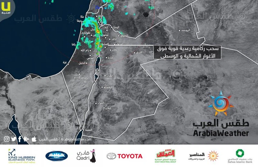
Urgent Warning of torrential rain due to heavy thunderstorms in the northern and central Jordan Valley
Written By وداد السعودي on 2020/02/19
This article was written originally in Arabic and is translated using a 3rd party automated service. ArabiaWeather is not responsible for any grammatical errors whatsoever.
Arab Weather - Northern and central Jordan Valley areas are exposed to heavy thunderstorms as a result of cumulative clouds crossing over these areas. And the weather of the Arabs recommends attention from the risk of torrents and flow of wadis.
It is noteworthy that the Kingdom has been affected since Tuesday night by a state of air instability
![]()
This article was written originally in Arabic and is translated using a 3rd party automated service. ArabiaWeather is not responsible for any grammatical errors whatsoever.
Browse on the official website
The spark of thunderstorms will begin in the south of the Kingdom and spread to the rest of the regions in the coming hours.Public security warns of expected weather conditions and calls for taking necessary precautions.The impact of the rainy weather system `Ghaith` will intensify across large parts of the Kingdom in the coming hours.Jordan: Rainfall forecast and affected areas during the rainy weather system.Jordan: Strong instability tonight as part of the first of the `Ghaith` rain series.Ongoing updates: List of countries that have announced the first day of Eid al-Fitr 1447 AH so farArab Weather names the prolonged rainy spell, which begins this evening and will continue throughout the Eid holiday and until the end of March, as `Ghaith`.Jordan will be observing the crescent moon of Shawwal on Thursday evening, the 29th of Ramadan 1447 AH.Saudi Arabia | Astronomer Abdullah Al-Khudairi settles the debate and determines the first day of Eid al-Fitr astronomically
