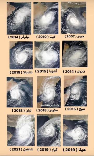
How do cyclones form off the coast of the Sultanate of Oman?!
Arab Weather - The Global Hurricane Monitoring website of the US Navy indicates that the Sultanate of Oman experiences a strong hurricane every three years, although 48% of it retreats before it reaches the coasts of the Sultanate. .
This is due to the geographical location of the Sultanate, which is the reason behind its exposure to different climatic conditions, as "its nature is similar to the nature of the southeastern regions of the United States, which are known for their dry coasts, which are a magnet for ocean cyclones."
The coast of Oman has previously been hit by several tropical cyclones. Perhaps the most powerful of them was Hurricane Gonu, which struck the western Arabian Sea in 2007, causing great damage to lives and losses to the Omani economy.
Among the most important hurricanes that hit Oman:
- Cyclone Gonu (2007): The Sultanate was hit by the strongest tropical cyclone and the intensity of the cyclone reached the fifth degree.
- Cyclone Phet (52010): a strong Category 4 cyclone that hit the coast of Oman on June 5, 2010.
- Cyclone Mekunu (2018): a tropical cyclone that formed on May 21, 2018 in the Arabian Sea.
- Hurricane Shaheen (2021):

The development of cyclones in the Arabian Sea is less frequent due to its small area compared to the oceans, in addition to the absence of contributing factors to their formation except in certain periods of the year, but global warming has caused an increase in the number of tropical storms and an increase in their frequency as well.
A study published in the journal Springer indicated that cyclones over the Arabian Sea have become more severe in recent decades.
Browse on the official website