Egypt | Hot to very hot weather and rising dust in some areas last week
Arab weather - It is expected that Egypt will continue to be affected by a hot air mass coming from the desert of the Arabian Peninsula, coinciding with the control of an air rise in the upper layers of the atmosphere, so that hot to very hot summer weather and temperatures higher than their natural rates during, and winds are active in parts of the Republic Egypt is exciting to dust and dust in some areas.
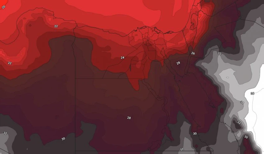
Hot summer weather in all regions
It is not expected that there will be a significant change in the temperatures in the coming days, to be higher than their normal rates for this time of the year by 4-6 degrees Celsius, so that relatively hot weather will prevail on the northern coasts and hot to very hot in Cairo and the entire Lower Egypt and northern Upper Egypt regions. And South Sinai, while it is very hot over the rest of the regions, exceeding the forties of degrees Celsius in the southern parts.
During the night hours, the weather is warm in the northern regions and relatively hot in the rest of the regions, and the relative humidity increases in the night and early morning hours on some coastal and inland regions, and the formation of daily mist is possible on a daily basis in different regions of the north of the Republic.
In light of this atmosphere, the Arab weather warns against direct and prolonged exposure to the sun, especially during the noon and afternoon hours, which may cause sunstrokes, God forbid, and the need to drink a lot of cold and hydrating fluids to replace the missing fluids from the body.
Activity on the movement of the wind exciting dust and dust
As a result of deepening low Sudan seasonal south of the republic, active northern winds are associated with strong sometimes donations working to raise dust, and is expected to operate on a low of visibility in some areas , particularly in the cities of Suez Gulf and parts of the northern areas , including Lower and Greater Cairo areas And parts of the southern region, and it will be turbulent in the Mediterranean and the Red Sea, but it will become moderate as of Tuesday.

Regarding these expectations and their direct impact on public life, it is worth alerting road users in general and external ones in particular of the low range of horizontal visibility, and it is also worth alerting respiratory and eye patients to the necessity of following the necessary preventive measures to deal with such weather conditions, and we ask God for safety. For everyone.
Browse on the official website