Information that might interest you... How do mountains become a real danger in cases of atmospheric instability?
Arab Weather - Every year during the fall season, what is known as atmospheric instability occurs. These unstable weather conditions coincide with thermal fluctuations, cloud cover, and increased chances of thunderstorms in areas affected by unstable weather conditions.
First, how do atmospheric instability occur?
Arab Weather experts say that atmospheric instability arises due to temperature differences between the upper and lower layers of the atmosphere. With the onset of autumn each year, and as cold air masses begin to push southward, temperature differences occur as these air masses pass through areas where hot, humid air from the south is concentrated.
Because warm air is low in density, it rises and, upon reaching the cold upper layers of the atmosphere, cools and condenses, forming cumulus clouds. As the same process is repeated, the clouds become denser as tropical moisture continues to flow from the south. These clouds become saturated with moisture, forming rain and hail.
Atmospheric instability is usually accompanied by the following weather phenomena:
- cumulus clouds
- random rainfall
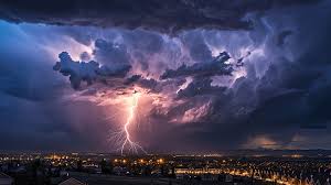
- Thunder and lightning
- hail
- Downdrafts form

But how do mountainous heights pose a danger in cases of atmospheric instability?
What you don't know about the danger of mountainous heights in cases of atmospheric instability
The danger of mountains during periods of atmospheric instability lies in their role in enhancing the flow of torrents into valleys. Mountainous areas are among the most sensitive areas during periods of atmospheric instability, as their complex terrain is a major factor in raising the risk level compared to plains or flat areas. This danger is particularly evident in the acceleration of cumulus cloud formation and increased rainfall intensity, in addition to the pushing of massive amounts of water into the surrounding valleys and plains.

Here are several reasons why mountainous areas are dangerous in cases of atmospheric instability:
1. The nature of mountains and their role in the formation of clouds and rain
When moist winds hit the mountainous heights, they rise upwards, causing the air to cool and condense, leading to the formation of cumulonimbus clouds.
2. Sloping terrain and increased water flow velocity
The steep nature of the mountain slopes causes rainwater to flow rapidly downwards, without finding a chance to seep into the ground. This steep slope doubles the force of the rainwater flow, transforming it into torrential floods that carry rocks and soil with them.
3. The role of mountains in concentrating water within valleys
Highlands are typically surrounded by deep valleys, which act as natural drainage channels for water coming down from the mountaintops. As rain flows down the slopes into the valleys, a forced pooling of water occurs, increasing the risk of flash floods.
4. Risks to populations and human activities
Flash floods can form in minutes, sweeping away vehicles, blocking roads, isolating villages and residential areas, and causing landslides.
Why are mountains more dangerous than others?
Because floods in flat areas may gather slowly and be less rapid, while rain in mountainous and sloping areas gathers and flows forcefully towards low-lying areas.
Browse on the official website