الساعة 13:30: آخر تحليل لصور الأقمار الاصطناعية
2019-01-16
2019-01-16T13:59:41Z

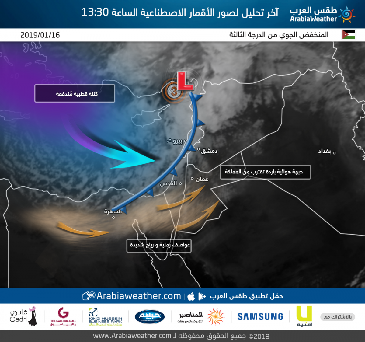
طقس العرب - تُشير آخر التحليلات الخاصة بصور الأقمار الاصطناعية إلى اقتراب دخول الجبهة الهوائية الباردة الرئيسية التابعة للمنخفض الجوي أجواء المملكة، بحيث تبدأ بعد قليل أمطار رعدية غزيرة و زخات بَرَد غزير في عِدة مناطق. أمام هذه الجبهة يُتوقع أن تندفع عواصف رملية و رياح شديدة مما يؤدي إلى تدني مدى الرؤية الأفقية في معظم الطُرق الصحراوية.
على الجانب الآخر، يُتوقع بدء تساقط الثلوج فوق المُرتفعات الجبلية العالية التي يزيد ارتفاعها عن 900متر عن سطح البحر في عِدة مناطق فور بدء عبور الجبهة الباردة.
This article was written originally in Arabic and is translated using a 3rd party automated service. ArabiaWeather is not responsible for any grammatical errors whatsoever.


Arabia Weather App
Download the app to receive weather notifications and more..