Saudi Arabia Active to strong winds accompany entry of the cold mass into the northern skies

2020-02-05 2020-02-05T12:51:18Z
سنان خلف
سنان خلف
محرر أخبار جوية- قسم التواصل الاجتماعي

Weather Arabs - Sinan behind - the northern parts of the daily Kingdom affected by Friday and Saturday , God willing , impulsively air mass cold coming from the north, t pay strong speed winds around parts of Tabuk, Arar, Gurayaat and Jouf, accompanied by donations exceeding speed turnpike 70 km / h.


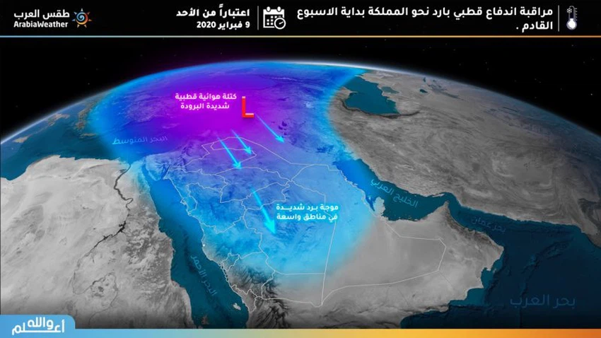
This high intensity wind will stir dust and dust in separate parts of Tabuk, Arar, Qurayyat and Al-Jawf , which may cause low visibility , which requires respiratory and ophthalmic patients to take precaution and follow the necessary precautions to deal with such weather conditions.


We also advise drivers and road users to follow the instructions for safe driving due to the expected low level of horizontal visibility, and we ask God for safety for all.

This article was written originally in Arabic and is translated using a 3rd party automated service. ArabiaWeather is not responsible for any grammatical errors whatsoever.
See More
Related News
Heavy thunderstorms in the Algerian capital, while hot and stable weather prevails in the capital, Amman.

Heavy thunderstorms in the Algerian capital, while hot and stable weather prevails in the capital, Amman.

Seasonal rains are expected to intensify in several Arab countries during the rest of July, with their peak occurring in these regions.

Seasonal rains are expected to intensify in several Arab countries during the rest of July, with their peak occurring in these regions.

Will the thunderstorms and hail that hit Abha happen again tomorrow?

Will the thunderstorms and hail that hit Abha happen again tomorrow?

 A cold air front will cross southwestern Europe and extend towards the northern Maghreb countries in the coming days.

A cold air front will cross southwestern Europe and extend towards the northern Maghreb countries in the coming days.