Temperatures in North Africa will be lower than in the Levant this weekend. How is that?

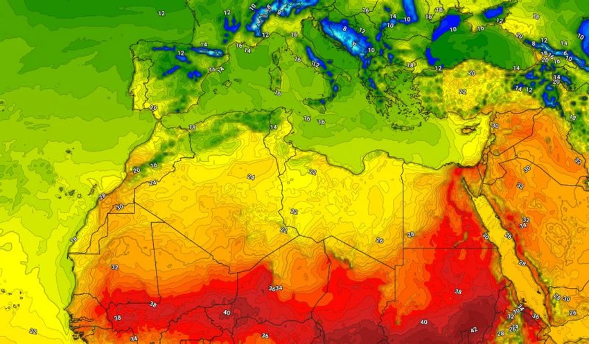
Arab Weather - Weather maps at the Arab Weather Center show that the distribution of weather systems during the end of this week is represented by the movement of a desert low pressure system (Khamasin) towards the eastern Mediterranean, specifically the Levant and Iraq, bringing with it winds with high temperatures and above average temperatures, laden with varying proportions of dust. In contrast, a cooler air mass is rushing behind the Khamasin low pressure system to North Africa, causing temperatures to drop in those regions.
Capitals in North Africa will record cooler temperatures than those in the capitals of the Levant.
With the North African countries, particularly the Maghreb and Libya, being influenced by the cooler air mass, maximum daytime temperatures range between 18 and 23 degrees Celsius. During the passage of the Khamaseen depression, temperatures in the capitals of the Levant reach around 30 degrees Celsius and exceed that in low-lying and desert areas.
The weather will be cold at night in the Maghreb and Libya, while it will be warmer than usual in the Levant during the weekend. This is typical of the spring transitional period, which is significantly affected by atmospheric and temperature fluctuations.
And God knows best.


Arabia Weather App
Download the app to receive weather notifications and more..