Egypt's weather: a sharp drop in temperatures, active winds and expected rain in many areas on Thursday and Friday

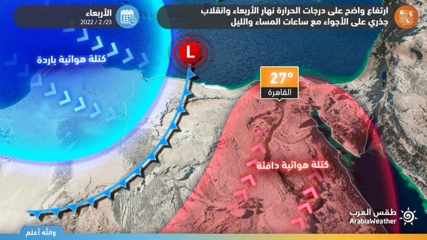
Weather of Arabia - On Thursday and Friday, February 24 and 25, 2022, the Republic of Egypt is affected by a cold air mass rushing from the center of the European continent, and in light of the availability of certain weather conditions that form an air depression south of Crete that affects the country during the next two days, God willing.
In the details, large areas of the European continent are still affected by an air rise in the different layers of the atmosphere, which means the continuation of stable and cold weather in many parts of it. And western Turkey, perhaps the last of which contributed to the formation of an air depression - at the present time - around the island of Crete. And it began with the actual impact (at the moment of preparing the report) on the west of the country, according to what the satellite images monitored.
The weather maps issued by global numerical models have a direct impact on Egypt, God willing, in the period from Wednesday night / Thursday to Saturday, so that temperatures are expected to drop significantly and sharply on Thursday. Relatively cold and rainy weather prevails in an uneven way, specifically in the north of the country This includes chances of rain showers, especially after noon hours on Thursday, February 24, 2022, in the northern coastal regions and parts of Lower Egypt and the Delta, all the way to parts of Greater Cairo and northern Upper Egypt.
The same weather maps indicate that the southwest winds are active, accompanied by strong gusts that sometimes exceed the 70 km/h barrier in some areas, especially desert and open areas, that raise dust and sand with a possibility of low horizontal visibility.
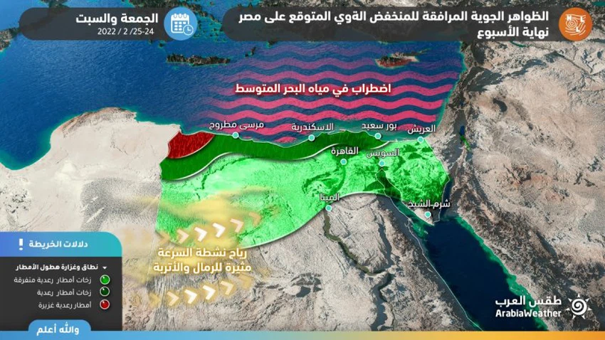
On Friday, God willing, the weather will continue to be relatively cold in the northern regions, and often cloudy, with a chance of rain showers, especially in the morning hours on the northern coastal regions and parts of Lower Egypt, the Delta, Sinai and Matrouh, all the way to parts of Greater Cairo and northern Upper Egypt. The winds will be northwesterly to northwesterly, active at speed, accompanied by strong gusts sometimes in some areas, especially desert and open areas, and the Mediterranean Sea is very turbulent.
As for Saturday, the amounts of clouds decrease in the sky of the country, and stable weather prevails in all regions, with the exception of parts of the Sinai Island, provided that temperatures rise from Sunday, God willing.


Arabia Weather App
Download the app to receive weather notifications and more..