Japan | Severe weather disturbances affecting the Republic, and expectations of rainfall approaching 500 mm during the coming days
Weather of Arabia - The Republic of Japan is experiencing severe weather disturbances, which today caused torrential torrential rains and floods in different regions of the Republic, and according to the numerical outputs received by the Air Operations Department of the Arab Weather Company, it is expected that more intensity will occur on the intensity of weather disturbances in the coming days on various The states of the republic, including the capital, Tokyo.
Weather disturbances continue for 10 days and heavy rains are expected
Weather turbulence is expected to continue over the Republic for at least 10 days, and its peak during the current week, specifically the coming days, so that severe thunderclouds are expected to form, and lead to heavy to very heavy rain, accompanied by thunderstorms and hail may fall heavily and in large sizes. This leads to the formation of torrential torrents and floods in large areas of the republic, especially in the western states.
These atmospheric disturbances are accompanied by great activity and wind speed, with the speed of some gusts approaching the 90 km/h barrier, causing waves to rise and turbulence on coastal areas, whether in the shores of the Sea of Japan or on the shores of the Pacific Ocean.
Cumulative rainfall amounts up to 500 mm in 10 days
Strong weather turbulence will be accompanied by huge amounts of rain in the coming days, with the amount of rain in some states reaching 500 mm, which is twice the rate of rain at Amman Civil Airport in the entire rainy season, where the average rainfall in the 6-year rainy season 245 mm months at Amman Civil Airport, while it is expected to record amounts of rain touching 500 mm within 10 days only in some states of Japan.
What caused the emergence of air disturbances with this violence?
After analyzing the numerical forecast models, it was noted that there are several things that would cause weather disturbances of this severity, the most important of which is the convergence of moist and less hot air currents from the Sea of Japan, with moist and hotter air currents from the Pacific Ocean, coinciding with the rise in surface water temperatures. The Pacific Ocean to about 30 degrees Celsius, which would increase the amount of water vapor rushing towards the different layers of the atmosphere, which helps to increase the intensity of thunderclouds.
Snapshots from today's Japan floods
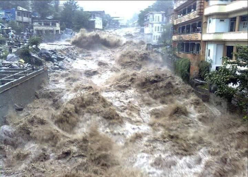

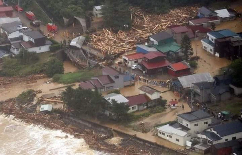
Image source is the atmosphere of Egypt page.
God knows.
Browse on the official website