Hurricane Fernand is forming near the Bermuda Triangle. Here's what will happen in the next 48 hours.

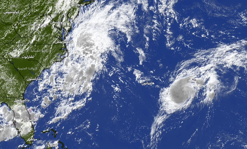
Latest satellite images show Tropical Storm Fernand continuing to develop in the Atlantic Ocean, east of the area known as the Bermuda Triangle, becoming the sixth storm recorded during the current hurricane season.
Weather observations indicate that wind speeds around the storm's center reached 65 kilometers per hour, while satellite images show the storm gradually moving north-northeast. The storm is expected to pass east of Bermuda through the open waters of the North Atlantic Ocean without direct impact on coastal areas, with the possibility of it developing into a Category 1 hurricane by Monday.
Another tropical wave is tracking through the Caribbean Sea.
Meanwhile, satellite images show a tropical wave with thunderstorms centered about 1,046 kilometers east of the Windward Islands in the Caribbean Sea.
Meteorologists have indicated that this wave is likely to develop over the coming days, moving westward at speeds between 32 and 40 kilometers per hour. It is expected to bring heavy rain and strong winds to parts of the Windward Islands on Monday, God knows best.


Arabia Weather App
Download the app to receive weather notifications and more..