Satellite images clearly monitor the snow accumulated over the mountains of the Kingdom

2023-02-11 2023-02-11T10:36:43Z
هشام جمال
هشام جمال
كاتب مُحتوى جوّي

Weather of Arabia - On Friday 10/2/2023, satellite images monitored snow covering the peaks of the governorates of Karak and Tafila, in addition to the heights of the governorates of Jerash and Ajloun, as shown in the map below.


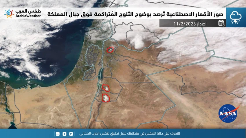
It is noteworthy that the Kingdom was affected by a fourth-degree depression from the afternoon of Monday 6/2/2023 until Wednesday 8/2/2023, which was accompanied by a very cold air mass, which caused snowfall and accumulation from the northern mountain highlands, and with a less sharpness from the central mountain highlands and later the Karak heights. And Tafila, and it is mentioned that the northern and southern mountainous heights enjoyed good accumulations of snow.

This article was written originally in Arabic and is translated using a 3rd party automated service. ArabiaWeather is not responsible for any grammatical errors whatsoever.
See More
Related News
After a 40-day hiatus, rainy weather returns to Jordan.

After a 40-day hiatus, rainy weather returns to Jordan.

Should Eid clothes be for spring or winter?

Should Eid clothes be for spring or winter?

Jordan/Friday: Cloudy skies during the day and rain in many areas at night, God willing.

Jordan/Friday: Cloudy skies during the day and rain in many areas at night, God willing.

Jordan: A deep low-pressure system with a path similar to a khamsin (a precipitation-like weather pattern) is causing widespread atmospheric instability.

Jordan: A deep low-pressure system with a path similar to a khamsin (a precipitation-like weather pattern) is causing widespread atmospheric instability.